//
For internal use only

Not On Display
Map
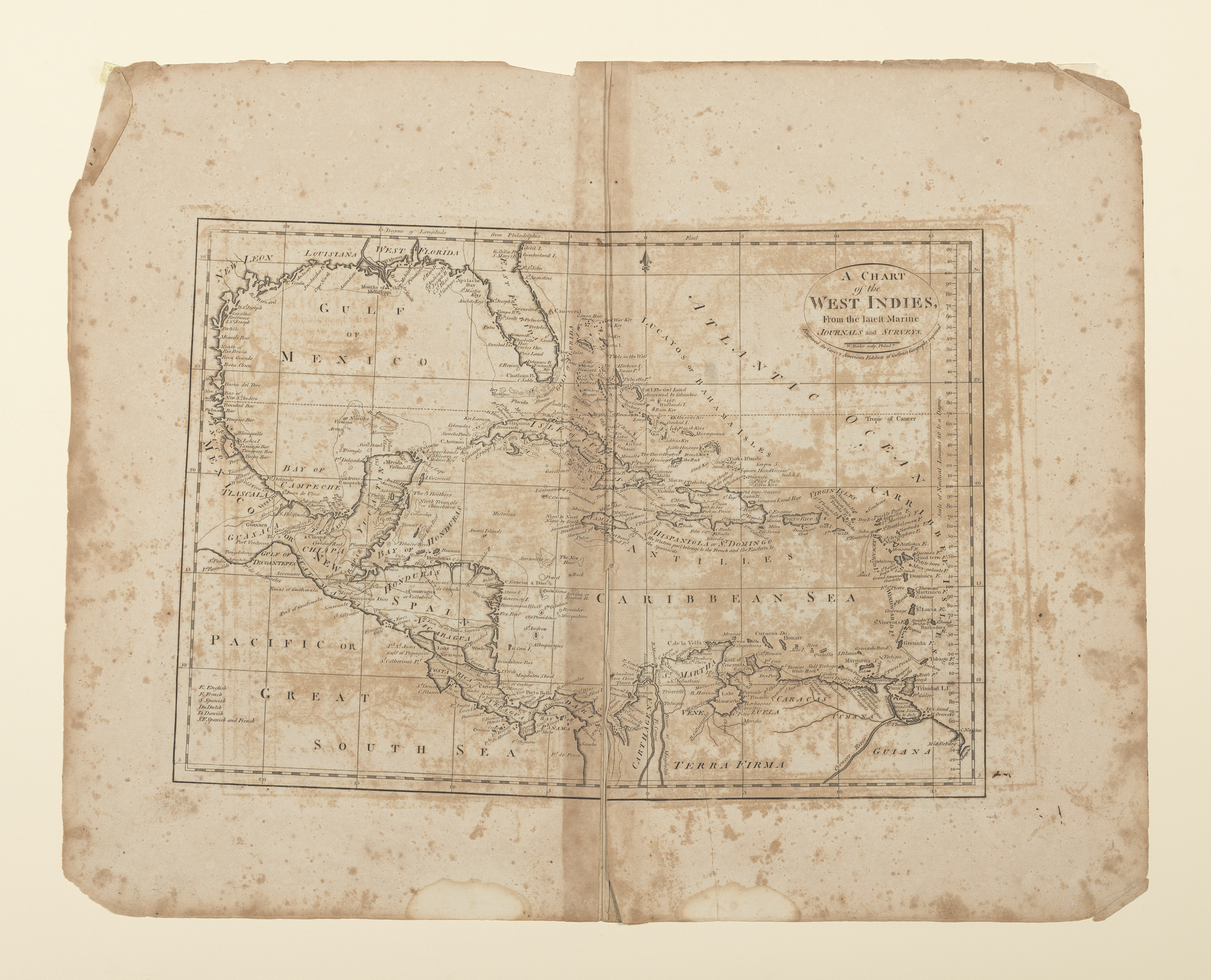
A CHART/ of the/ WEST INDIES,/ From the latest Marine/ JOURNALS and SURVEYS.
William Barker, Matthew Carey
1795-1818
Category
Prints and Maps
Creator/Artist/Maker
William Barker (Engraver)
Place of Origin
Philadelphia; Pennsylvania; Philadelphia; Mid-Atlantic; United States; North America
Materials
- Ink
- Paper (laid)
Museum Object Number
1954.0026.008
Credit Line/Donor
Gift of Dean A. Fales, Jr.
Share Object
Complete Details
Object Number
1954.0026.008
Object Name
Map
Title
A CHART/ of the/ WEST INDIES,/ From the latest Marine/ JOURNALS and SURVEYS.
Category
Prints and Maps
Creator (Role)
William Barker (Engraver); Matthew Carey (Publisher)
Place of Origin
Philadelphia; Pennsylvania; Philadelphia; Mid-Atlantic; United States; North America
Date
1795-1818
Mark/Signature/Inscription/Label
Type: Inscription
Location: Top right below title
Inscription: W. Barker, sculp.
Type: Inscription
Location: Top right beneath cartouche
Inscription: Engraved for Carey's American Edition of Guthrie's Geography
Mark/Signature: Yes
Materials
- Ink
- Paper (laid)
Techniques
- Etched
- Engraved
Dimensions (inches)
16.75 (H) x 21.1825 (W) x 11.0625 (Image H) x 15.8725 (Image W)
Dimensions (centimeters)
42.545 (H) x 53.804 (W) x 28.099 (Image H) x 40.316 (Image W)
Measurement Notes
H at left. W at bottom. Plate H (at left): 11.4375 in. (29.0 cm). Plate W (at bottom): 16.75 in. (42.54 cm). Chain intervals and laid lines per cm not measured.
Publisher Summary
M. Carey
Place of Publication
Philadelphia, Philadelphia County, Pennsylvania, Mid-Atlantic, United States, North America
Publisher Name
M. Carey
Edition Watermark
none
Edition Notes
From Carey's American Edition of Guthrie's Geography Improved (Philadelphia: Mathew Carey, 1795, first ed.). Subsequent editions were published in 1796, 1800, and at frequent intervals until 1818. Needs to be researched if this map appeared in all editions or if can be identified as coming from one in particular.