//
For internal use only

Not On Display
Map
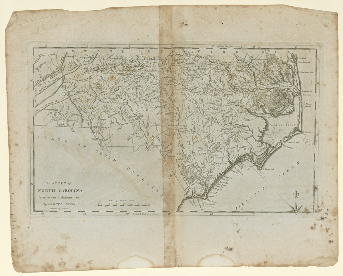
The STATE of/ NORTH CAROLINA/ from the best Authorities, &c./ by SAMUEL LEWIS.
John Vallance, Samuel Lewis, Matthew Carey
1795-1818
Category
Prints and Maps
Creator/Artist/Maker
John Vallance (Engraver)
Place of Origin
Philadelphia; Pennsylvania; Philadelphia; Mid-Atlantic; United States; North America
Materials
- Ink
- Paper (laid)
Museum Object Number
1954.0026.005
Credit Line/Donor
Gift of Dean A. Fales, Jr.
Share Object
Complete Details
Object Number
1954.0026.005
Object Name
Map
Title
The STATE of/ NORTH CAROLINA/ from the best Authorities, &c./ by SAMUEL LEWIS.
Category
Prints and Maps
Creator (Role)
John Vallance (Engraver); Samuel Lewis (Cartographer); Matthew Carey (Publisher)
Place of Origin
Philadelphia; Pennsylvania; Philadelphia; Mid-Atlantic; United States; North America
Date
1795-1818
Mark/Signature/Inscription/Label
Type: Inscription
Location: Bottom left
Inscription: ...by SAMUEL LEWIS.
Type: Inscription
Location: Bottom left beneath title
Inscription: Engraved by Vallance.
Mark/Signature: Yes
Materials
- Ink
- Paper (laid)
Techniques
- Etched
- Engraved
Dimensions (inches)
16.875 (H) x 21.0625 (W) x 11 (Image H) x 18.4375 (Image W)
Dimensions (centimeters)
42.862 (H) x 53.499 (W) x 27.94 (Image H) x 46.831 (Image W)
Measurement Notes
H at left. W at bottom. Plate H (at left): 11.25 in. (28.575 cm). Plate W (at bottom): 19.0 in. (48.26 cm). Chain intervals and laid lines per cm not measured.
Publisher Summary
M. Carey
Place of Publication
Philadelphia, Philadelphia County, Pennsylvania, Mid-Atlantic, United States, North America
Publisher Name
M. Carey
Edition Watermark
none
Edition Notes
This map first appeared in Carey's American Edition of Guthrie's Geography improved (Philadelphia: Mathew Carey, 1795, first ed.). Subsequent editions were published in 1796, 1800, and at frequent intervals until 1818. It might also be from Carey's Pocket Atlas (Philadelphia: M. Carey, 1802). Needs to be researched if this map appeared in all editions or if can be identified as coming from one in particular.