//
For internal use only

Not On Display
Map
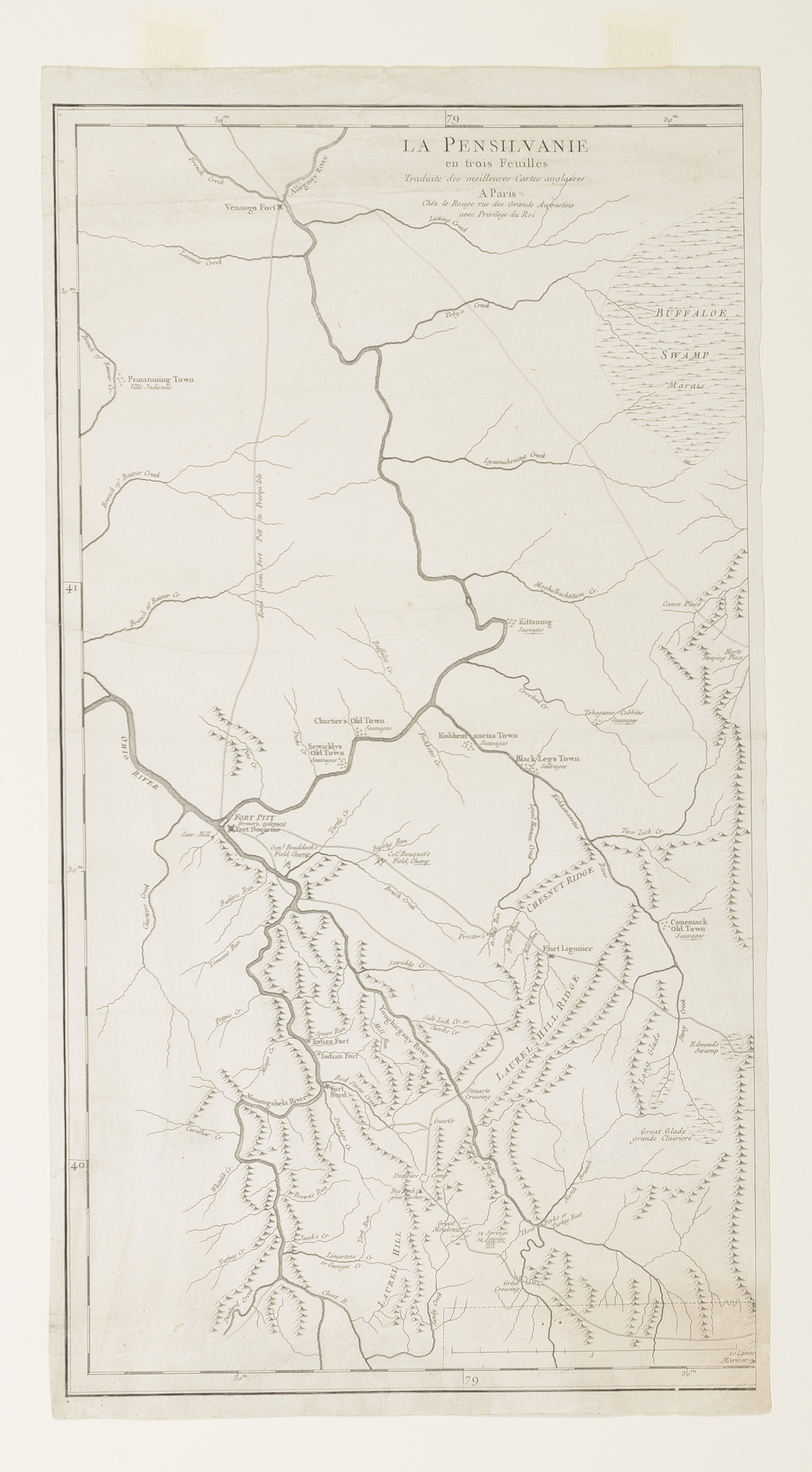
LA PENSILVANIE/ en trois Feuilles/ Traduite des meilleures Cartes anglaises// A MAP OF/ PENNSYLVANIA/ EXHIBITING/ not only THE IMPROVED PARTS of that PROVINCE, but also/ ITS EXTENSIVE FRONTIERS:
George Louis Le Rouge
1778
Category
Prints and Maps
Creator/Artist/Maker
George Louis Le Rouge (Cartographer and publisher)
Place of Origin
Paris; France; Europe
Materials
- Ink
- Paper (laid)
Museum Object Number
1984.0021 A- C
Credit Line/Donor
Museum purchase
Share Object
Complete Details
Object Number
1984.0021 A- C
Object Name
Map
Title
LA PENSILVANIE/ en trois Feuilles/ Traduite des meilleures Cartes anglaises// A MAP OF/ PENNSYLVANIA/ EXHIBITING/ not only THE IMPROVED PARTS of that PROVINCE, but also/ ITS EXTENSIVE FRONTIERS:
Category
Prints and Maps
Creator (Role)
George Louis Le Rouge (Cartographer and publisher)
Place of Origin
Paris; France; Europe
Date
1778
Mark/Signature/Inscription/Label
Type: Inscription
Location: Upper left of map
Inscription: Chéz le Rouge rue des Grands Augustines / avec Privilege du Roi.
Mark/Signature: Yes
Materials
- Ink
- Paper (laid)
Techniques
- Etched
- Engraved
Measurement Notes
Left sheet: Overall: H: 27.4 in. (69.7cm). W: 14.7 in. (37.3 cm). Image: H: 26.3 in. (66.7 cm). W: 14.1 in. (35.7 cm). Center sheet: Overall: H: 27.2 in. (69.2 cm). W: 19.6 in. (49.8 cm). Image: H: 26.2 in. (66.5 cm). W: 18.7 in. (47.6 cm). Right sheet: Overall: H: 27.2 in. (69.1 cm). W: 20.3 in. (51.5 cm). Image: H: 26.1 in. (66.3 cm). W: 19.3 in. (49.1 cm).
Publisher Summary
G. Le Rouge
Publisher Date
01/01/1778
Place of Publication
Paris, France
Publisher Name
G. Le Rouge
Edition Watermark
None
Coloring
Hand colored with watercolors
Edition Notes
From Georges Louis le Rouge's Atlas Ameriquain Septentrional, Paris 1778.