//
For internal use only

Not On Display
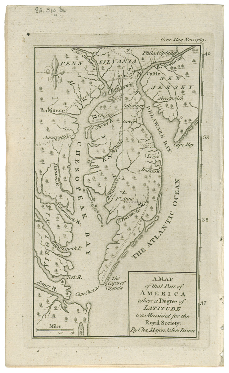
Map
A MAP/ of that Part of/ AMERICA/ where a Degree of/ LATITUDE/ was Measured for the/ Royal Society:/ By Cha. Mason, & Jere. Dixon.
David Henry, Cha. Mason & Jere. Dixon
November 1769 (1769-1769)
Category
Prints and Maps
Creator/Artist/Maker
David Henry (Publisher)
Place of Origin
London; London; England; United Kingdom; Europe
Materials
- Ink
- Paper (laid)
Museum Object Number
1982.0310 A
Credit Line/Donor
Museum purchase
Share Object
Complete Details
Object Number
1982.0310 A
Object Name
Map
Title
A MAP/ of that Part of/ AMERICA/ where a Degree of/ LATITUDE/ was Measured for the/ Royal Society:/ By Cha. Mason, & Jere. Dixon.
Category
Prints and Maps
Creator (Role)
David Henry (Publisher); Cha. Mason & Jere. Dixon (Surveyor)
Place of Origin
London; London; England; United Kingdom; Europe
Date
November 1769 (1769-1769)
Mark/Signature/Inscription/Label
Type: Inscription
Location: Bottom right in inset
Inscription: .../ By Cha. Mason, & Jere. Dixon.
Mark/Signature: Yes
Subject(s)
- Book illustration
Materials
- Ink
- Paper (laid)
Techniques
- Engraved
- Etched
Dimensions (inches)
8 (H) x 5 (W) x 6.5 (Image H) x 3.9375 (Image W)
Dimensions (centimeters)
20.32 (H) x 12.7 (W) x 16.5 (Image H) x 10.001 (Image W)
Measurement Notes
H at right. W at top. Plate H: 6.9375 in. (17.62 cm). Plate W: 4.25 in. (10.7 cm). Chain interval: 2.8 cm; laid lines per cm not measured.
Publisher Summary
D. Henry
Publisher Date
11/01/1769
Place of Publication
St. John's Gate, London, England, United Kingdom, Europe
Publisher Name
D. Henry
Edition Watermark
none
Edition Notes
Map bound facing page 567 in Sylvanus Urban, The Gentleman's Magazine for December 1769 (London: Printed for D. Henry, at St. John's Gate.)