//
For internal use only

Not On Display
Map
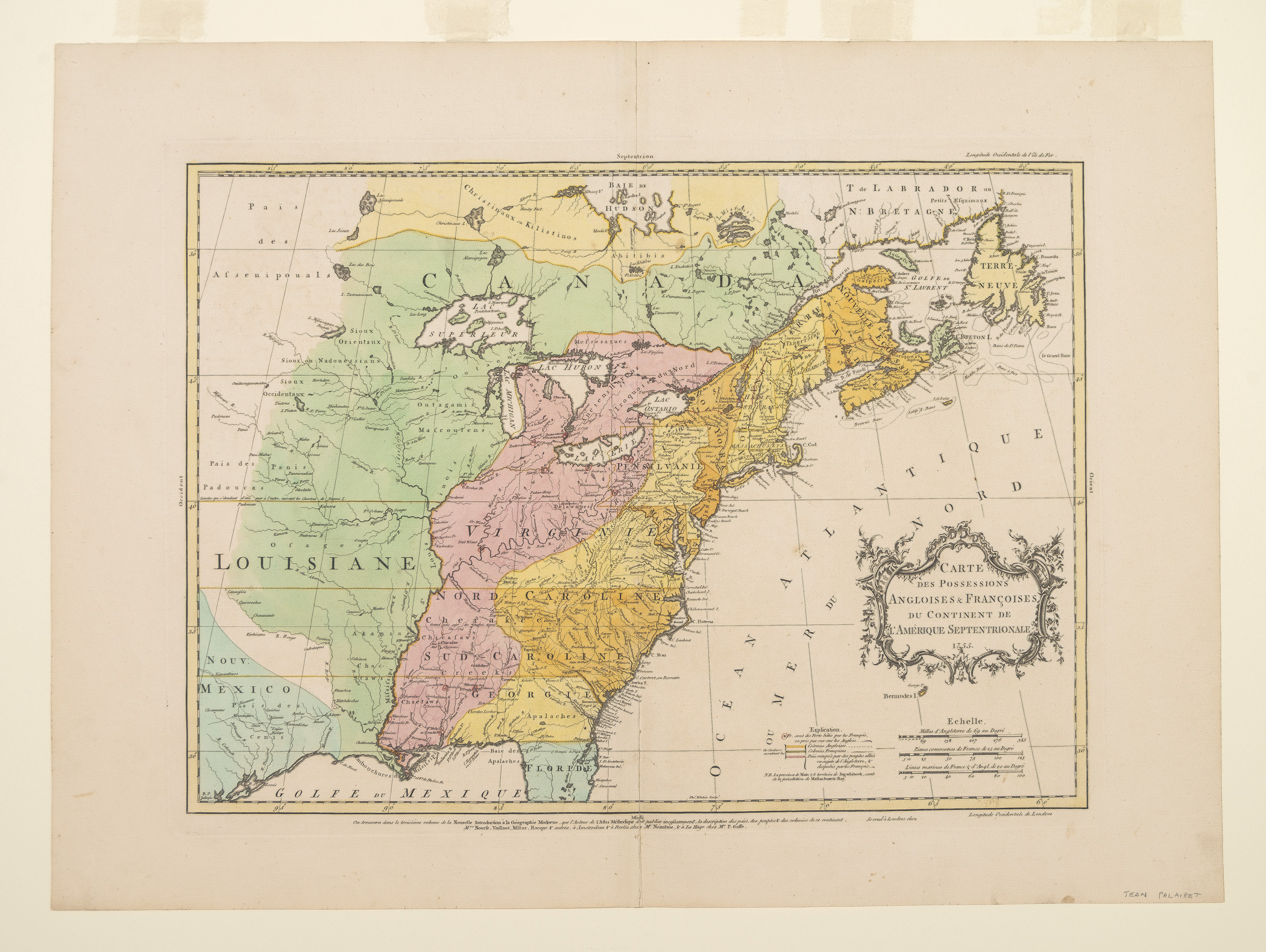
CARTE DES POSSESSIONS ANGLOISES & FRANÇOISES DU CONTINENT DE L'AMÉRIQUE SEPTENTRIONALE
Jean Palairet, Thomas Kitchin
1755
Category
Prints and Maps
Creator/Artist/Maker
Jean Palairet (Cartographer)
Place of Origin
London; London; England; United Kingdom; Europe
Materials
- Ink
- Watercolor
- Paper (laid)
Museum Object Number
1980.0036
Credit Line/Donor
Museum purchase
Share Object
Complete Details
Object Number
1980.0036
Object Name
Map
Title
CARTE DES POSSESSIONS ANGLOISES & FRANÇOISES DU CONTINENT DE L'AMÉRIQUE SEPTENTRIONALE
Category
Prints and Maps
Creator (Role)
Jean Palairet (Cartographer); Thomas Kitchin (Engraver)
Place of Origin
London; London; England; United Kingdom; Europe
Date
1755
Mark/Signature/Inscription/Label
Type: Inscription
Location: Lower center, within image
Inscription: Tho.\s Kitchin Sculp.\t
Mark/Signature: Yes
Materials
- Ink
- Watercolor
- Paper (laid)
Techniques
- Etched
- Engraved
- Hand colored
- Painted
Construction Description
Two large pieces of laid paper attached together on the verso.
Dimensions (inches)
21.8 (H) x 29.6 (W) x 17 (Image H) x 23 (Image W)
Dimensions (centimeters)
55.4 (H) x 75.1 (W) x 43.2 (Image H) x 58.5 (Image W)
Measurement Notes
Plate H: 17.5 in. (44.4 cm). Plate W: 23.6 in. (60 cm).
Publisher Date
01/01/1755
Place of Publication
Paris, London, Amsterdam, Berlin, The Hague.
Edition Watermark
None
Coloring
Hand colored with watercolors
Edition Notes
From Jean Palairet's Atlas Methodique, Paris, et al. 1755 (reissued in 1775), which included 53 maps and was published in folio.