//
For internal use only

Not On Display
Map
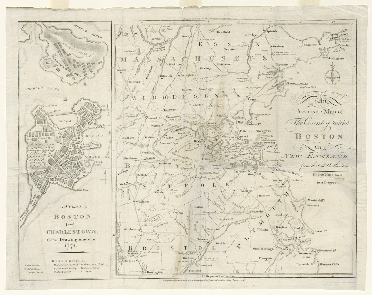
A PLAN of / BOSTON / and / CHARLESTOWN; / from a Drawing made in / 1771. // An / Accurate Map of / The Country round / BOSTON / in / NEW ENGLAND / from the best Authorities.
A. Hamilton Jr.
January 16 1776 (1776-1776)
Category
Prints and Maps
Creator/Artist/Maker
A. Hamilton Jr. (Publisher)
Place of Origin
London; London; England; United Kingdom; Europe
Materials
- Ink
- Paper (laid)
Museum Object Number
1976.0234
Credit Line/Donor
Museum purchase with funds provided by the Charles E. Merrill Trust for the Purchase of English Objects
Share Object
Complete Details
Object Number
1976.0234
Object Name
Map
Title
A PLAN of / BOSTON / and / CHARLESTOWN; / from a Drawing made in / 1771. // An / Accurate Map of / The Country round / BOSTON / in / NEW ENGLAND / from the best Authorities.
Category
Prints and Maps
Creator (Role)
A. Hamilton Jr. (Publisher)
Place of Origin
London; London; England; United Kingdom; Europe
Date
January 16 1776 (1776-1776)
Mark/Signature/Inscription/Label
Type: Inscription
Location: Lower center
Inscription: Publish'd as the Act directs by A. Hamilton Jun\r near S\t John's Gate Jan 16 1776.
Mark/Signature: Yes
Materials
- Ink
- Paper (laid)
Techniques
- Engraved
- Etched
- Line engraved
Dimensions (inches)
13.7 (H) x 17.4 (W) x 12.7 (Image H) x 16.3 (Image W)
Dimensions (centimeters)
34.8 (H) x 44.2 (W) x 32.2 (Image H) x 41.4 (Image W)
Measurement Notes
Plate H: 13 in. (32.9 cm). Plate W: 16.8 in. (42.7 cm).
Publisher Summary
A. Hamilton
Publisher Date
01/16/1776
Place of Publication
London, England, United Kingdom
Publisher Name
A. Hamilton
Edition Watermark
None
Edition Notes
From: The Town and Country Magazine, or, Universal Repository of Knowledge, Instruction, and Entertainment (London, A. Hamilton, Jr., 1769-1796, 28 vols.).