//
For internal use only

Not On Display
Map
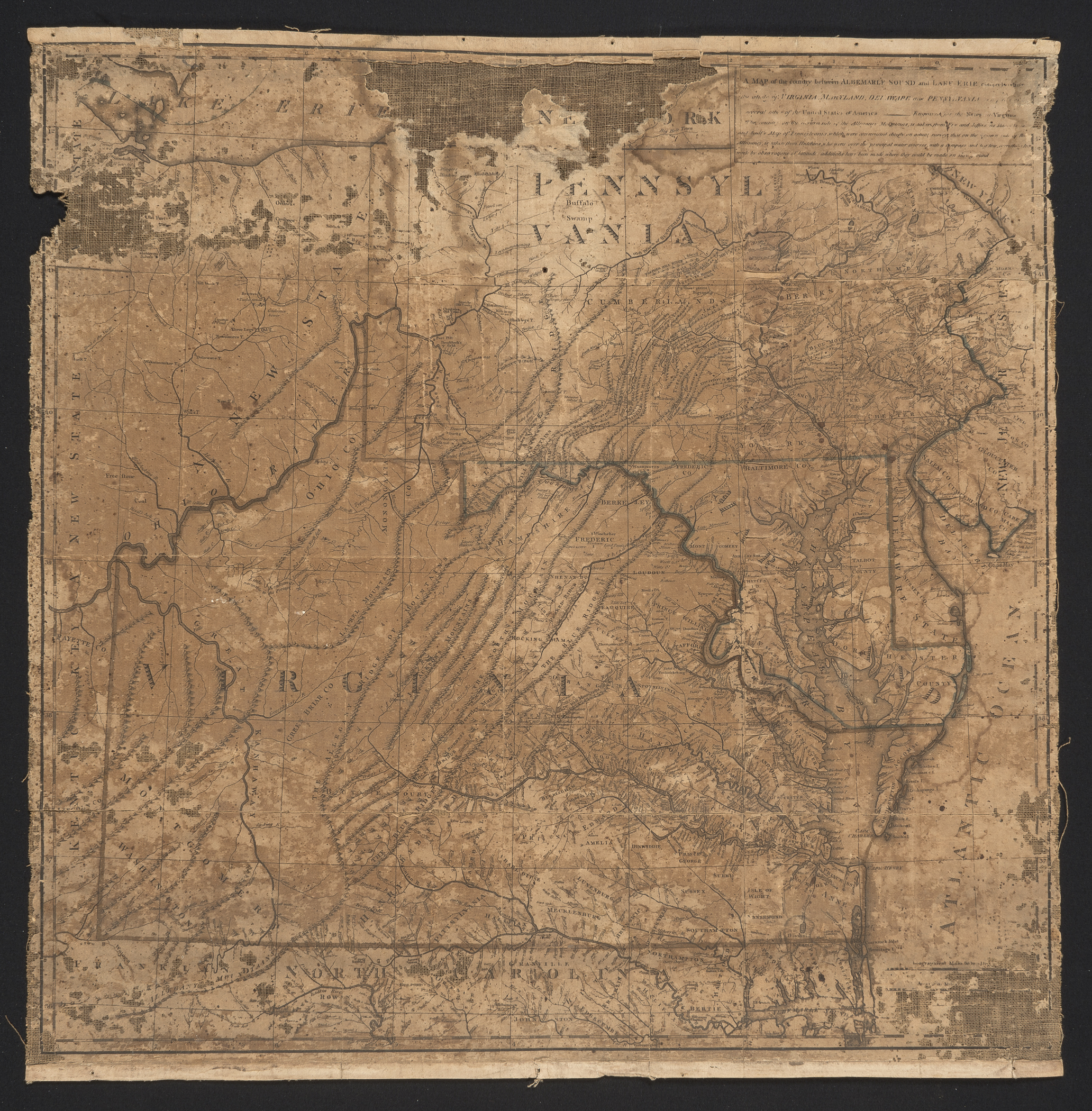
A MAP of the Country between ALBEMARLE SOUND and LAKE ERIE comprehending/ the whole of VIRGINIA, MARYLAND, DELAWARE, and PENNSYLVANIA [with parts of]/ several other of the United States of America.
Thomas Jefferson, John Stockdale
1787-1790
Category
Prints and Maps
Creator/Artist/Maker
Thomas Jefferson (Mapmaker)
Place of Origin
London; London; England; United Kingdom; Europe
Materials
- Ink
- Watercolor
- Paper (laid)
- Linen
- Wood
Museum Object Number
1969.3747
Credit Line/Donor
Bequest of Henry Francis du Pont
Share Object
Complete Details
Object Number
1969.3747
Object Name
Map
Title
A MAP of the Country between ALBEMARLE SOUND and LAKE ERIE comprehending/ the whole of VIRGINIA, MARYLAND, DELAWARE, and PENNSYLVANIA [with parts of]/ several other of the United States of America.
Category
Prints and Maps - Maps and Prints Study Collection
Creator (Role)
Thomas Jefferson (Mapmaker); John Stockdale (Publisher)
Place of Origin
London; London; England; United Kingdom; Europe
Origin Notes
The plate was engraved and printed in London.
Secondary Place of Origin
Paris; France; Europe
Secondary Origin Notes
Jefferson prepared his map in Paris and sent it to London to be engraved.
Date
1787-1790
Materials
- Ink
- Watercolor
- Paper (laid)
- Linen
- Wood
Techniques
- Line Etched
- Engraved
Dimensions (inches)
24.25 (H) x 24 (W) x 23.25 (Image H) x 23.375 (Image W)
Dimensions (centimeters)
61.595 (H) x 60.96 (W) x 59.055 (Image H) x 59.373 (Image W)
Measurement Notes
H and W of paper. H at left. W at bottom.
Publisher Summary
J. Stockdale
Place of Publication
Piccadilly, London, England, United Kingdom, Europe
Publisher Name
J. Stockdale
Coloring
Hand colored with watercolors