//
For internal use only

Not On Display
Map
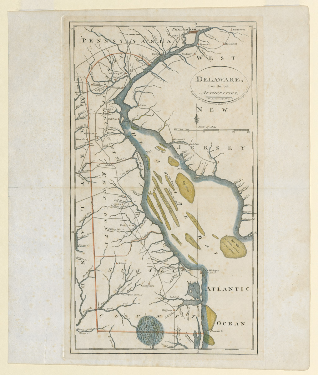
DELAWARE/ from the best/ AUTHORITIES.
William Barker, Matthew Carey
1795-1818
Category
Prints and Maps
Creator/Artist/Maker
William Barker (Engraver)
Place of Origin
Philadelphia; Pennsylvania; Philadelphia; Mid-Atlantic; United States; North America
Materials
- Ink
- Watercolor
- Paper (laid)
Museum Object Number
1969.0417 A
Credit Line/Donor
Gift of Mrs. Alfred C. Harrison
Share Object
Complete Details
Object Number
1969.0417 A
Object Name
Map
Title
DELAWARE/ from the best/ AUTHORITIES.
Category
Prints and Maps
Creator (Role)
William Barker (Engraver); Matthew Carey (Publisher)
Place of Origin
Philadelphia; Pennsylvania; Philadelphia; Mid-Atlantic; United States; North America
Date
1795-1818
Mark/Signature/Inscription/Label
Type: Inscription
Location: Upper left, bottom center in cartouche
Inscription: W. Barker: sculp. Philad.\a
Type: Inscription
Location: Upper left, beneath cartouche
Inscription: Engraved for Carey's American Edition of Guthrie's Geography improved.
Mark/Signature: Yes
Materials
- Ink
- Watercolor
- Paper (laid)
Techniques
- Line engraved
- Stipple engraved
- Hand colored
- Painted
Dimensions (inches)
17.54 (H) x 14.5 (W) x 16.05 (Image H) x 9 (Image W)
Dimensions (centimeters)
44.54 (H) x 36.82 (W) x 40.77 (Image H) x 22.9 (Image W)
Measurement Notes
OH at right. OW at bottom. Plate H: 16.6 in. (42.1 cm). Plate W: 9.7 in. (24.6 cm). Chain interval: 2.6-2.7cm.
Publisher Summary
M. Carey
Place of Publication
Philadelphia, Philadelphia County, Pennsylvania, Mid-Atlantic, United States, North America
Publisher Name
M. Carey
Edition Watermark
Shield with a fleur-de-lis in crowned shield over the letters "LYG" at top center; countermark of "BICKINGS"
Coloring
Hand colored with watercolors
Edition Notes
From Carey's American Edition of Guthrie's Geography Improved (Philadelphia: Mathew Carey, 1795, first ed.). Subsequent editions were published in 1796, 1800, and at frequent intervals until 1818. Needs to be researched if this map appeared in all editions or if can be identified as coming from one in particular.