//
For internal use only

Not On Display
Map
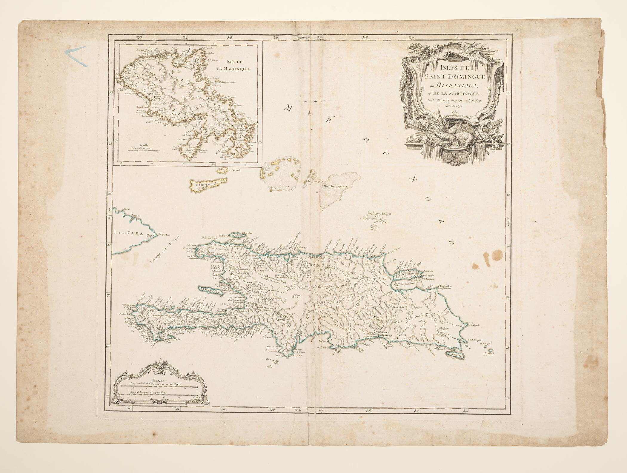
ISLES DE SAINT DOMINGUE ou HISPANIOLA, et DE LA MARTINIQUE
Robert de Vaugondy, Gilles (Cartographer), Robert de Vaugondy, Didier (Cartographer), Antoine Boudet
1750
Category
Prints and Maps
Creator/Artist/Maker
Robert de Vaugondy, Gilles (Cartographer), Robert de Vaugondy, Didier (Cartographer) (Cartographer and publisher)
Place of Origin
Paris; France; Europe
Materials
- Ink
- Watercolor
- Paper (laid)
Museum Object Number
1961.0422.004
Credit Line/Donor
Gift of Mrs. G. Brooks Thayer
Share Object
Complete Details
Object Number
1961.0422.004
Object Name
Map
Title
ISLES DE SAINT DOMINGUE ou HISPANIOLA, et DE LA MARTINIQUE
Category
Prints and Maps
Creator (Role)
Robert de Vaugondy, Gilles (Cartographer), Robert de Vaugondy, Didier (Cartographer) (Cartographer and publisher); Antoine Boudet (Printer)
Place of Origin
Paris; France; Europe
Date
1750
Mark/Signature/Inscription/Label
Type: Inscription
Location: Upper right, within cartouche
Inscription: Par le S.\R ROBERT Geographe ord. du Roy
Mark/Signature: Yes
Materials
- Ink
- Watercolor
- Paper (laid)
Techniques
- Engraved
- Etched
- Hand colored
- Painted
Construction Description
Two large pieces of laid paper attached together on the verso.
Dimensions (inches)
21.3 (H) x 29.6 (W) x 19 (Image H) x 20.4 (Image W)
Dimensions (centimeters)
54.2 (H) x 75.2 (W) x 48.2 (Image H) x 51.7 (Image W)
Measurement Notes
Plate H: 19.7 in. (50 cm). Plate W: 21.3 in. (54.2 cm).
Publisher Summary
Robert de Vaugondy, Gilles (Cartographer), Robert de Vaugondy, Didier (Cartographer)
Publisher Date
01/01/1757
Place of Publication
Paris, France
Publisher Name
Robert de Vaugondy, Gilles (Cartographer), Robert de Vaugondy, Didier (Cartographer)
Edition Watermark
Unidentified watermark and countermark featuring a windmill and text and date "1712".
Coloring
Hand colored with watercolors
Edition Notes
From: Atlas Universel, Par M. Robert Geographe ordinaire du Roy, et Par M. Robert De Vaugondy son fils Geographe ord. du Roy, et de S. M. Polonoise, Duc de Lorraine et de Bar, et Associe de L'Academie Royale des Sciences et belles Lettres de Nancy, Avec Privilege Du Roy, 1757. A Paris, Chez Les Auteurs, Quay de l'Horloge du Palais, Boudet Libraire Imprimeur du Roi, rue St. Jacques. Grave par Ch. Baquoy. J. Oger Scripsit, et al.