//
For internal use only

On Display: House - Sixth Floor Hall-Outside Shipley
Map
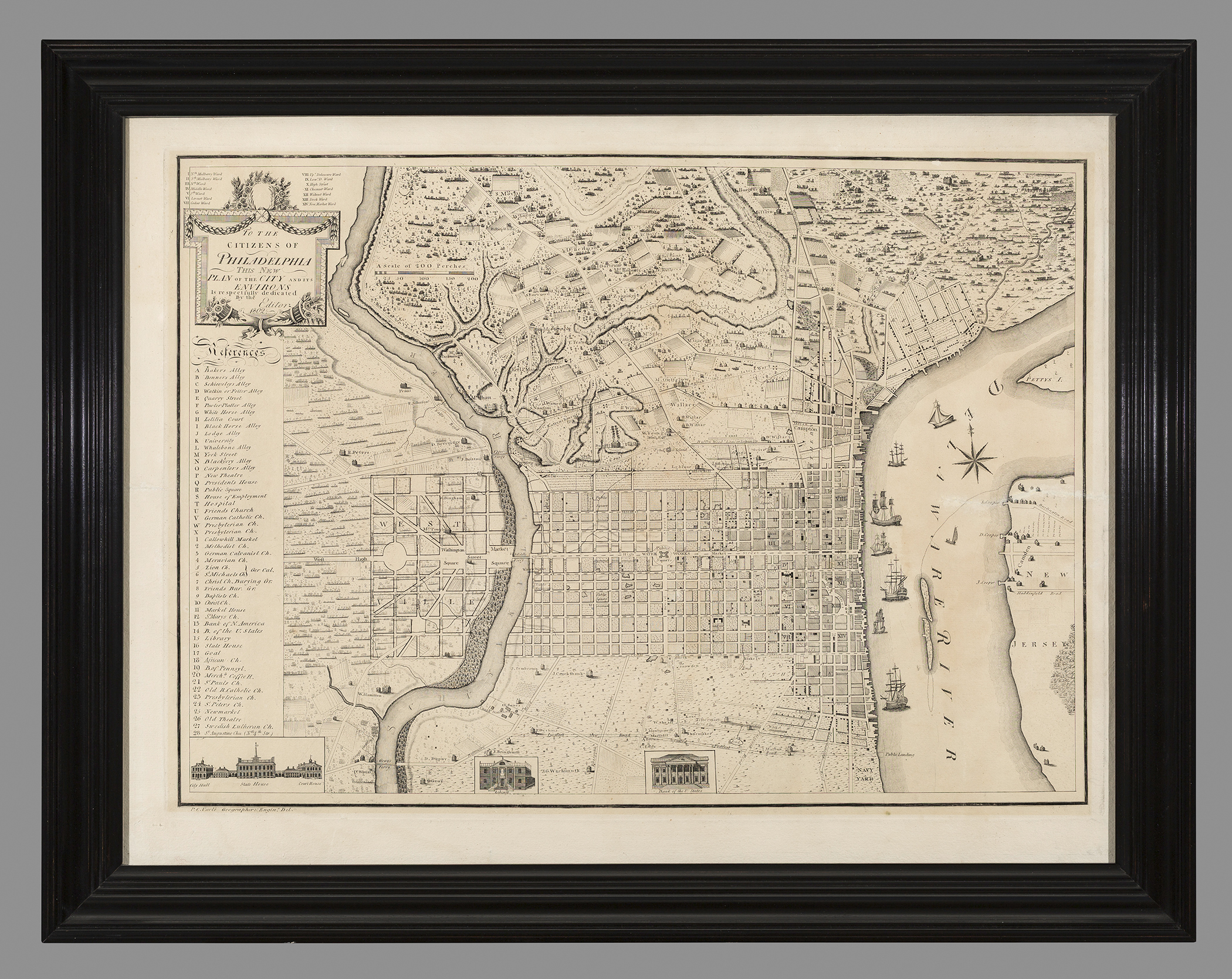
Plan of the City of Philadelphia and its Environs
Pierre Charles Varle, Robert Scot
1802-1802
Category
Prints and Maps
Creator/Artist/Maker
Pierre Charles Varle (Cartographer)
Place of Origin
Philadelphia; Pennsylvania; Philadelphia; Mid-Atlantic; United States; North America
Materials
- Ink
- Paper (laid)
Museum Object Number
1960.0358.001 A
Credit Line/Donor
Museum purchase
Share Object
Complete Details
Object Number
1960.0358.001 A
Object Name
Map
Title
Plan of the City of Philadelphia and its Environs
Category
Prints and Maps
Creator (Role)
Pierre Charles Varle (Cartographer); Robert Scot (Engraver)
Place of Origin
Philadelphia; Pennsylvania; Philadelphia; Mid-Atlantic; United States; North America
Date
1802-1802
Mark/Signature/Inscription/Label
Type: Inscription
Location: Lower left below image
Inscription: P. C. Varle Geographer & Enginr. Del.
Mark/Signature: No
Subject(s)
- City view
Materials
- Ink
- Paper (laid)
Techniques
- Etched
- Engraved
Dimensions (inches)
20.591 (H) x 26.969 (W)
Dimensions (centimeters)
52.3 (H) x 68.5 (W)
Measurement Notes
Overall measurements are of paper. Plate dimensions are: 46.2 cm. (H) by 64.o cm. (W). The image measures: 44.8 cm (H) by 62.0 cm. (W).
Frame measurements: 61.2cm. (left side), 77.7 cm. (bottom edge).