//
For internal use only

Not On Display
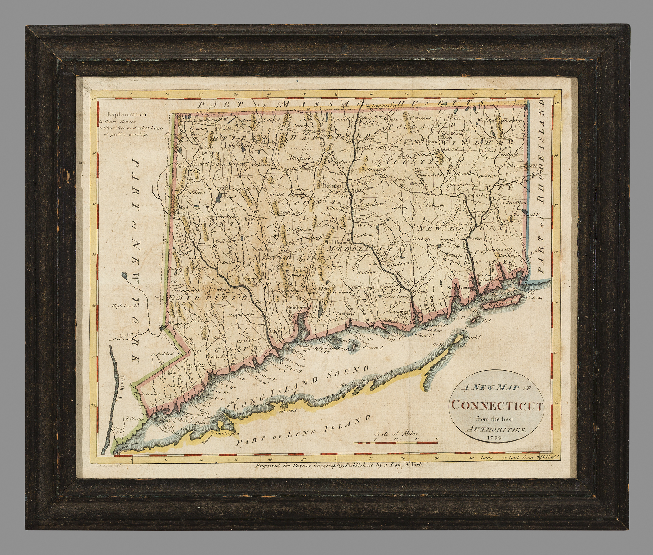
Map (Line engraving)
A NEW MAP OF/ CONNECTICUT/ from the best/ AUTHORITIES.
Alexander Anderson, John Payne, John Low
1799
Category
Prints and Maps
Creator/Artist/Maker
Alexander Anderson (Engraver)
Place of Origin
New York; New York; Mid-Atlantic; United States; North America
Materials
- Ink
- Watercolor
- Paper (laid)
Museum Object Number
1959.2444 A
Credit Line/Donor
Bequest of Henry Francis du Pont
Share Object
Complete Details
Object Number
1959.2444 A
Object Name
Map (Line engraving)
Title
A NEW MAP OF/ CONNECTICUT/ from the best/ AUTHORITIES.
Category
Prints and Maps
Creator (Role)
Alexander Anderson (Engraver); John Payne (Cartographer); John Low (Publisher and seller)
Place of Origin
New York; New York; Mid-Atlantic; United States; North America
Date
1799
Mark/Signature/Inscription/Label
Type: Inscription
Location: Lower center
Inscription: Engraved for Paynes Georgraphy, Published by J. Low, N. York.
Type: Inscription
Location: Lower left
Inscription: A. Anderson del.
Mark/Signature: Yes
Materials
- Ink
- Watercolor
- Paper (laid)
Techniques
- Engraved
- Etched
- Line engraved
- Hand colored
- Painted
Dimensions (inches)
8 (H) x 9.8 (W) x 7.4 (Image H) x 9.6 (Image W)
Dimensions (centimeters)
20.2 (H) x 25 (W) x 18.8 (Image H) x 24.5 (Image W)
Measurement Notes
Measurements by sight, in frame. H at left. W at bottom.
Publisher Summary
J. Low
Place of Publication
New York, New York, Mid-Atlantic, United States, North America
Publisher Name
J. Low
Coloring
Hand colored with watercolors
Edition Notes
John Payne, A New and Complete System of Universal Geography. 4 vols. (New York: John Low, 1798-1800).